

CeRDI Team compete in Gov Hack 2019
A five-person team of CeRDI staff going by the name of "Team CeRDIfy" presented their concept for a future planning and land zoning tool at the GovHack 2019 event held in Ballarat in early September.
GovHack is an annual, international competition, focussing on open data projects which are developed in teams and presented in the course of a 46-hour event. A free, inclusive and all ages hackathon, its aim is to see inventive, problem-solving applications of open government data sets.
The competition has proven to be a great forum for launching data initiatives, with the 2014 winning entry RainParrot going on to become a top-selling weather app.
This year’s Ballarat event was held at the Ballarat Tech School at Federation University’s city (SMB) campus, providing participants with open areas and breakout spaces to work dynamically in teams.
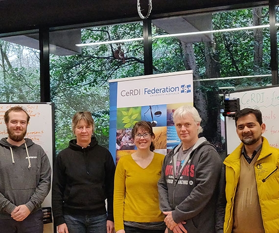
The CeRDIfy Team, lead by Technical Assistant Dan Ferguson, presented the Innovative Land Index (ILI). Additional CeRDIfy team members included Dr Angela Neyland (GIS analysis and video editing), Dr Basharat Ali (research), Chris Bahlo (research) and Derek Walters (research).
 |
|
The CeRDIfy Team from left to right: Dan Ferguson, Chris Bahlo, Dr Angela Neyland, Derek Walters, and Dr Basharat Ali. |
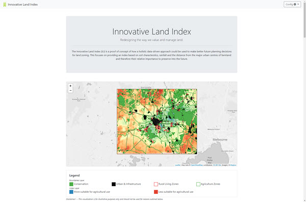
The Innovative Land Index is a spatial mapping tool and index using soil characteristics, rainfall and distance of farmland from major urban centres of farmland to determine relative importance of land for purposes of preservation, land zoning decision-making and planning.
The tool may be used by town planners, farmers, environmental managers and the wider community and would provide the means to holistically interpret and visualise complex and layered data sets to analyse land use, land value and optimal planning.
The CeRDIfy Team highlighted issues of increasing population, urban sprawl and reduction of food miles as some of the driving social and environmental issues behind the development of the tool.
The team drew on seven publicly available government data sets including the Agriculture Victoria Soil API, Vicmap Features of Interest, OpenStreetMap, Planning Scheme Zones and BOM Average Annual Rainfall (Vic), amongst others, as the foundation data sets for the tool. Future layers which could be usefully integrated into the ILI include cultural, land use, groundwater, water catchment and crop values data.
Within the 46-hour time limit the team successfully fulfilled the criteria laid out for all GovHack participants, to create a descriptive project page, a record of data used, evidence repository and 3-minute video entry.
Team CeRDIfy’s video entry "The Innovate Land Index" can be viewed below:
A screenshot of the CeRDIfy’s team website can be seen below:
 |
|
CeRDIfy’s team website - https://www.ili.best/ |
We congratulate the team on their great effort at GovHack 2019 and wish them success with entries in the state, national and international award rounds.
Visit the GovHack website for further information.