

Measuring the Economic, Environmental and Social Impacts of Landslides and Floods in the Grampians Region
The social, economic, and environmental impacts of the 2011 landslides and floods in and around the Grampians National Park in Victoria were investigated, with a particular emphasis on risk and resilience, from the perspectives of emergency services and infrastructure personnel, residents, businesses, and community organisations. The research findings contribute to the evidence base on the impact of landslide events which are of interest both nationally and internationally.
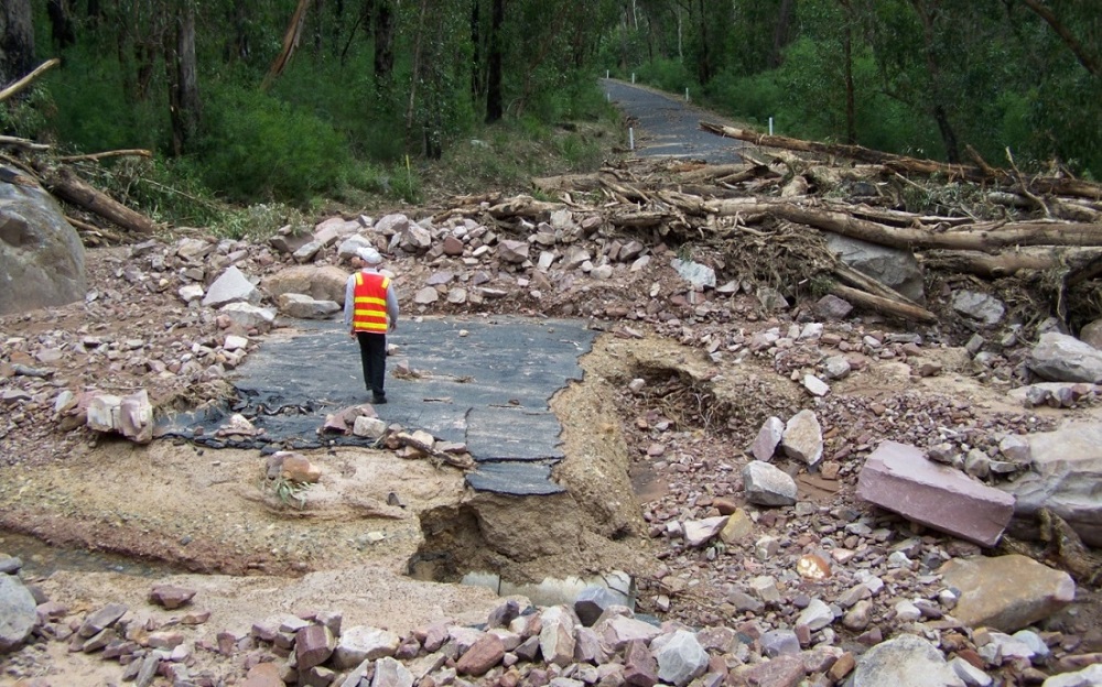 |
| Pavement and culvert damage, Silverband Rd (source VicRoads) |
Background
In January 2011, an intense rainfall event in Western Victoria caused widespread regional flooding and triggered over 190 landslides in the Grampians National Park. This event had significant impacts on the environment and communities both in and surrounding the park.
Subsequently, the Northern Grampians Shire Council, together with project partner organisations, commissioned CeRDI to undertake research to examine the impact of this natural disaster, with specific focus on addressing risk and resilience. Funding for this project was provided by a Natural Disaster Resilience Grant Application with in-kind contributions from partner organisations.
The overall aim of this study was to investigate the social, economic, and environmental impacts of the 2011 landslides and floods in and around the Grampians National Park. A core objective of the research was to identify the impacts of the natural disaster on communities, with insights collected from residents, businesses, and from local and regional government and non-government agencies.
Outcomes
Extensive research was conducted and a detailed report outlining the social, economic, and environmental impacts was completed in 2014. Key findings from the research identified:
- Catalysts for effective preparation and response to the Grampians Natural Disaster, including past experience and local knowledge, communication, and coordination; and
- Challenges experienced in the preparation and response to the disaster event, including the blurring of agency roles during the response, communication between agencies and with the community, and the complexities of the community response
- Social impacts on emergency services personnel (including fatigue, anxiety attributed to being assigned new roles, lack of training in landslide response and going beyond the call of duty), on individuals and residents (e.g., due road closures, some damage to buildings and fences, the positive impact of being able to cope with future natural disasters) and on businesses and community organisations (including personal anxiety due to loss of income due to reduced tourism). The minimal social impact of this event suggests that the community is quite adaptable and resilient to natural disasters.
- Economic impacts e.g., costs to emergency management and infrastructure organisations, including intangibles associated with staff burn-out and lack of preparedness and planning for landslide events, costs to businesses due to loss of income from reduced tourism, recovery phase outcomes, including increased employment and skill-building from recovery construction work the economic value of which were estimated to outweigh the tourism losses
- Environmental impacts, including severe scouring of riparian vegetation along the gullies where fast-moving debris flows occurred and the impact of debris from the landslides which flowed into Lake Bellfield, the major source of water supply for many towns and farms in the Wimmera region.
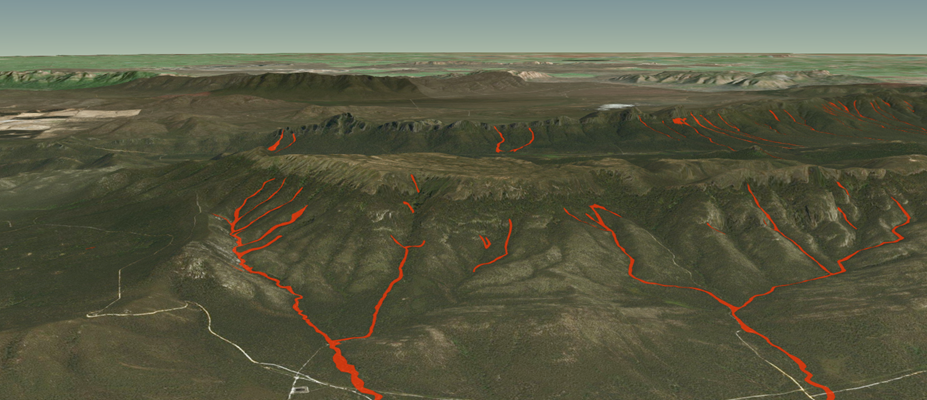
In addition, data for the 2011 landslides in the affected region were spatially mapped and complemented by photographic documentation. Reports and relevant literature about this and other similar events were collated and made publicly available via the Grampians Natural Disaster Research website.
The project was completed in 2014.
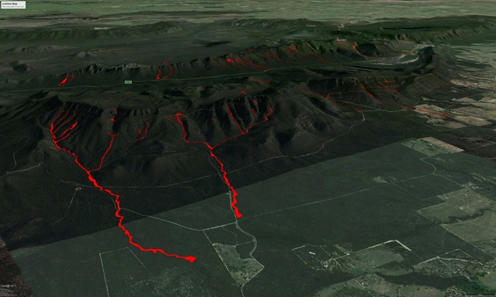 |
| Grampians Natural Disaster Research - Google Earth Map |
-

RESEARCH OUTPUT
Ollerenshaw, A. Dahlhaus, P.G. McDonald, K. Courvisanos, J. Graymore, M. Thompson, H. Sheil, H. Miner, A. Corbett, J. Understanding the 2011 Grampians Natural Disaster, addressing the risk and resilience. Final Report 2014.
Ollerenshaw, A. Graymore, M. and McDonald, K. (2016) Beyond the call of duty: the integral role of local government in emergency management. Rural Society, 25(3), 185–203.
doi.org/10.1080/10371656.2016.1255476
Cameron, J. (2013). ‘Landslide Mapping & Processes in the Grampians, Victoria’, Honours Research Thesis, Bachelor of Applied Science (Honours) - Geology, University of Ballarat, Ballarat. Victoria, Australia.
Federation University Honours project associated with this research. James Cameron’s thesis Landslide Mapping and Processes in the Grampians Victoria
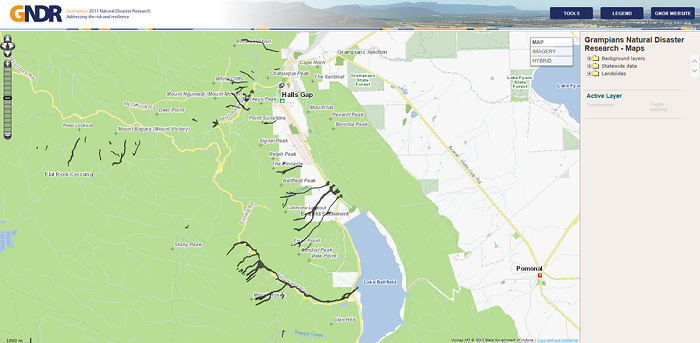
Grampians Natural Disaster Research - Map
-

PARTNERS
Northern Grampians Shire Council
Lead Organisation, key project contributor and representative organisation on project steering committee

Horsham Rural City Council
Project partner and contributor; steering committee organisational member

Ararat Rural City Council
Project partner and contributor; steering committee organisational member

VicRoads
Project partner and contributor; steering committee organisational member

Parks Victoria
Project partner and contributor; steering committee organisational member

Southern Grampians Shire Council
Project partner and contributor; steering committee organisational member

Victorian Country Fire Authority
Project partner and contributor; steering committee organisational member

A.S. Miner Geotechnical
Subcontracting organisation contributing to the research
Victorian Department of Justice
Project partner and contributor; steering committee organisational member

State Emergency Service
Project contributor; steering committee organisational member