


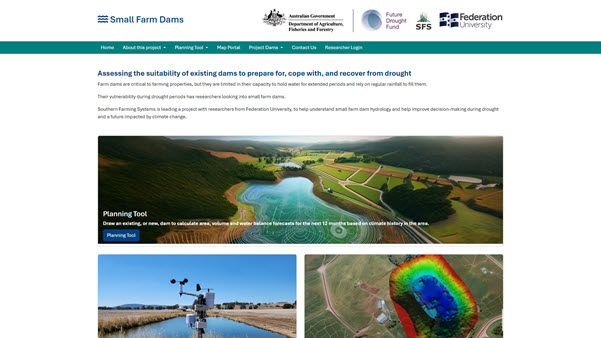
Small Farm Dams
Researchers at CeRDI have been using drones and sonar surveys to map dam structures in Victoria, with the aim of improving water security for farmers. These provide a comprehensive view of dam structures and will assist land holders to better manage water security on their properties.
 |
Background
Commencing in 2022, this three-year project is led by Southern Farming Systems ![]() and involves researchers from the Future Regions Research Centre (FRRC)
and involves researchers from the Future Regions Research Centre (FRRC) ![]() and the Centre for eResearch and Digital Innovation (CeRDI) teaming up to understand small farm dam hydrology and improve decision-making during drought and a future impacted by climate change. The $1 million project is part of the Victorian Drought Resilience Adoption and Innovation Hub
and the Centre for eResearch and Digital Innovation (CeRDI) teaming up to understand small farm dam hydrology and improve decision-making during drought and a future impacted by climate change. The $1 million project is part of the Victorian Drought Resilience Adoption and Innovation Hub ![]() , funded by the Federal Government’s Future Drought Fund. Thirteen dams are included in the study, located across Victoria, including in Wangaratta, Gippsland, Bendigo and across Southwest Victoria.
, funded by the Federal Government’s Future Drought Fund. Thirteen dams are included in the study, located across Victoria, including in Wangaratta, Gippsland, Bendigo and across Southwest Victoria.
Innovation, Approach, and Technical Features
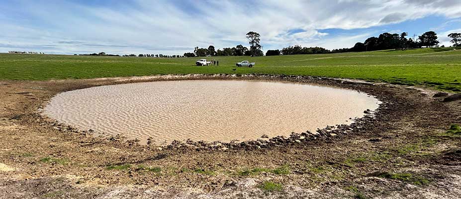
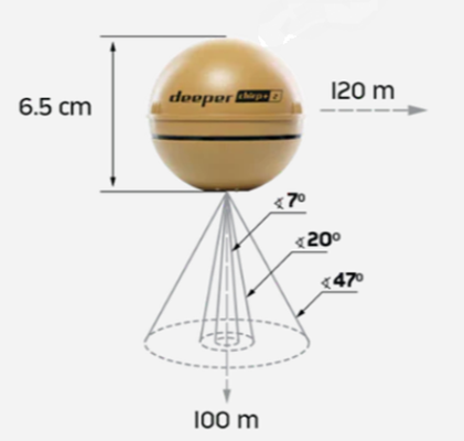
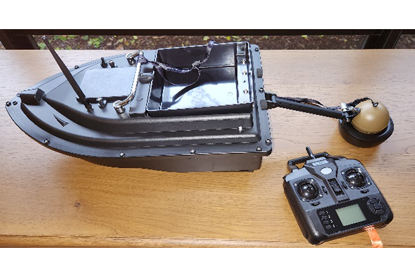
A licenced drone operator was used for the LiDAR data capture of five of the 13 dams in the study. Sonar data was captured for all the dams in the study area. CeRDI’s Rick Pope and Peter Weir utilised sonar equipment fitted to a small, remote-controlled boat. Depth readings were stored by an Android mobile app as the boat traversed the dam, covering a range of up to 120 meters and capable of measuring depths of up to 100 meters, delivering data assessments of the underwater topography of the dams. The area was also mapped using a drone equipped with LiDAR capturing millions of data points for both dam locations. 585.6 million data points were collected from one dam, and 1.02 billion data points for the other 4 dams.
CeRDI Research Associate Rick Pope commented:
Precise ground control points were captured via RTK GPS, achieving remarkable accuracy to 10 mm horizontally and 20 mm vertically. Advanced processing transformed the raw LiDAR point cloud data into highly detailed 3D models, enhancing visualisation and analysis capabilities of the five dams under review.
The combination of drone LiDAR and low-cost sonar represents a major development for technology use for mapping dams. With this new approach, engineers and environmental experts can collect a comprehensive dataset of dams that can be used by landholders, farmers and researchers, to inform future water planning and maintenance.
Sonar equipment used to survey dam topography
Sonar equipment attached to radio-controlled boat to survey dam topography
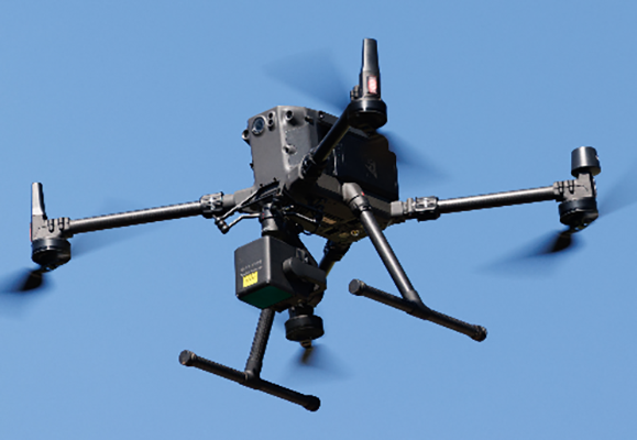
Lidar drone
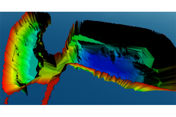
3D bathymetric map of Dam2D
Future Directions
The project will be completed during 2025, culminating in the delivery of online tools to enable farmers to draw their catchment over a dam and calculate the water balance predictions. This extends the work previously completed by the CeRDI team in the Lake Corangamite region which led to the development of a tool for farmers about drainage lines, watershed areas and surface water flow directions. Federation University researchers will continue to collect farm dam monitoring and other data to support future research.

VIDEOS

NEWS
Technology revolutionises farm dam mapping - 13 March 2025
Researchers at CeRDI have been using drones and sonar surveys to map dam structures in Victoria.... Continue reading...
Understanding the big role of small farm dams
 - 24 March 2022 - 7 March 2023

PARTNERS
Partner nodes
Southern Farming Systems
(Primary and Southwest Node)
Birchip Cropping Group
(North West Node)
Riverine Plains
(Northeast Node)
Food and Fibre Gippsland
(Southeast Node)Research partners

Federation University
(Primary research partner)