CULTURE


Visualising Ballarat
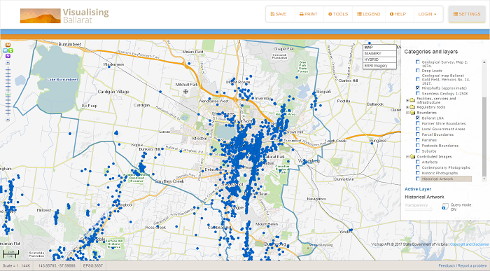
Visualising Ballarat is a mechanism for knowledge building and for planning, enabling end users to directly access complex data sets from a single point of access and to participate in the localised knowledge building process. The data sets available include data relating to historic landscapes, trees, parks, views, and landmarks, natural landscapes, geology, services and infrastructure, boundaries, and regulatory tools.
 |
Background
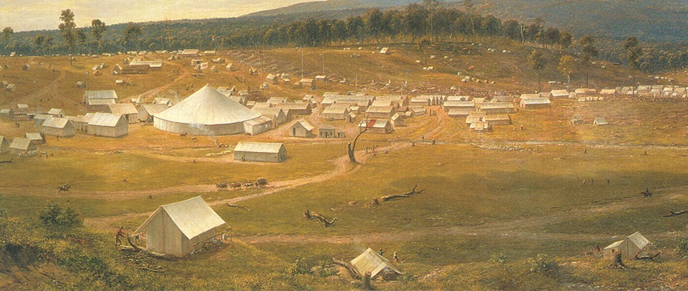
Visualising Ballarat has been developed to support the City of Ballarat’s Historic Urban Landscapes (HUL) portal. The HUL portal is one of the strategies developed for Ballarat, as a member of the United Nations Educational, Scientific and Cultural Organization (UNESCO) Historic Urban Landscape Global project, to ensure the city continues to retain its character, landscape, and cultural significance as it grows.
Conceptually, Visualising Ballarat seeks to enable end users to directly access complex data sets from a single point of access, and to participate in the localised knowledge building process. These data sets are varied and include data relating to historic landscapes, trees, parks, views, and landmarks, natural landscapes, geology, services and infrastructure, boundaries, and regulatory tools.
In addition, a goal of CeRDI was that Visualising Ballarat would inspire other researchers and bring a greater understanding of the power of eResearch and digital innovation at a local, national, and global level to support collaboration, knowledge building, research, and decision support.
While categorised as a tool for knowledge and planning, Visualising Ballarat is also a tool for engagement and partnership building. It provides an effective demonstration of how a number of data sets are able to be captured and used to visualise, through mapping and spatial imagery, features that enable users to better understand their landscape and to plan for future development of this landscape.
Outcomes
Innovative spatial mapping and knowledge sharing tools are being combined to empower community members and help local organisations contribute to the management of Ballarat as a unique historic urban landscape.
The participatory UNESCO supported HUL and Visualising Ballarat portals have been established to provide insight into Ballarat’s past, present and sustainable futures. HUL and Visualising Ballarat have been designed to help stakeholders, community members, practitioners and researchers come together in a collaborative way to identify community values, landscape values, acceptable levels of change and to provide certainty to residents and developers as to priority development to attract and support.
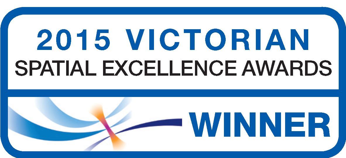
The Historic Urban Landscape (HUL) and Visualising Ballarat project received the 2015 Victorian Spatial Excellence Award for People and Community. The Award for People and Community recognises initiatives that make a difference to national, regional, or local issues and affect communities via ‘grass roots’ initiatives, and/or educational programs, services or tools that permit the widespread adoption, use, understanding and access to spatially enabled products or services.
Technical Features
Visualising Ballarat, as a planning and knowledge building tool is characterised by:
- Having a single site for the end user to access multiple data sets across a range of areas and points of interest/relevance. This capacity is particularly relevant to the planning and knowledge building process as it allows multiple and diverse data sets to be overlaid, compared, and analysed simultaneously. This provides access to ‘hidden’ data that is often overlooked when data sets are analysed separately and then cross referenced. This potentially allows for the gaining of new insights and for the building of new knowledge through which to inform planning.
- Allowing for retention of ownership and control over data by custodians while data sets are accessed through data base access agreements. This is an important feature of Visualising Ballarat as it extends the potential for involvement without any compromising of rights and responsibilities and control of data ownership.
- Being interoperable. Data housed within the Visualising Ballarat portal has maximum potential for currency as any changes, updates, modification to data in the originating data set (when updated/modified by data custodians) will be automatically updated within the Visualising Ballarat site. This is a significant benefit in terms of data accuracy, quality, and the associated confidence able to be built amongst end users relating to data integrity.
- Having the potential for end users to input information about issues specific to their field, their knowledge of local issues and concerns or to identify data shortfalls and make this information available. These can then become part of the mapping/data set.
- Providing online support and feedback loops to maximise flexibility and ease of implementation.
Future Directions
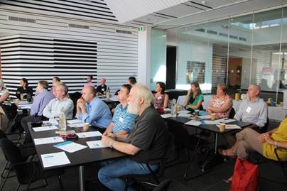 | |
| Participants at the HUL/Smart Cities workshop at | |
Currently, the core function of Visualising Ballarat has been linked to concepts specific to HUL implementation.
Visualising Ballarat could provide the entry point to a range of resources contributed by multiple partners.
There is potential for Visualising Ballarat to be expanded for greater use as a tool for forward planning, to capture critical aspects of Ballarat’s complex living landscape, and to provide a resource through which engagement and knowledge potential across a range of areas is maximised.
The types of data sets with the potential for inclusion is broad (and still being explored and developed), providing visualisations (currently 2D but expanding to 3D and 4D through technological development initiatives), relevant historical and contemporary information and information specific to individual locations and points/issues of interest to the end user.
In March 2016 CeRDI, together with representatives from the City of Ballarat, conducted a workshop to establish a collaborative strategy for the future progression and transformation of Visualising Ballarat. The workshop included staff from the City of Ballarat and representatives from organisations including the Museum of Australian Democracy Eureka (MADE), Southern Rural Water and the Public Records Office. The workshop format comprised core activities and presentations, culminating in a discussion on how innovation in Ballarat is aligned with international imperatives for combining technology, creativity, and community to create a Smart City.
-

RESEARCH OUTPUT
A paper outlining CeRDI’s vision for Visualising Ballarat is at https://www.cerdi.edu.au/cb_pages/files/visualising_ballarat_past_present_future.pdf
Murphy, A., Ollerenshaw, A., Taylor, M., Tsilemanus, A., Corbett, J., Thompson, H., Dahlhaus, P.G. Historic Urban Landscape and Visualising Ballarat Impact Analysis. CeRDI Report 2015. Available at
http://www.hulballarat.org.au/resources/IMPACT%20ANALYSIS_First%20wave%20HUL_Report_FINAL2.pdf

-

NEWS
Visualising Ballarat - Spring 2017
Visualising Ballarat offers state-of-the-art knowledge management and urban planning tools (http://www.visualisingballarat.org.au). Continue reading...
CeRDI featured in premier spatial publication - Winter 2016
An article profiling CeRDI’s spatial research has been published in the latest issue of Position magazine. Continue reading...
Workshop: Smart Cities – Building the future - Autumn 2016
In early March, CeRDI worked in collaboration with the City of Ballarat to conduct a workshop to establish a collaborative strategy for the future progression and transformation of Visualising Ballarat. Continue reading...
Federation University and Corangamite CMA win Asia Pacific Spatial Excellence Award - 18 April 2016
CeRDI and the Corangamite Catchment Management Authority were recently awarded an Asia Pacific Spatial Excellence Award which was announced during the Locate16 conference in Melbourne.... Continue reading...
2015 Victorian Spatial Excellence Awards winners - 12 September 2015
CeRDI has been recognised and honoured at the Victorian Spatial Excellence Awards 2015 receiving both the Award for People and Community and the Award for Environment and Sustainability.... Continue reading...
-

PARTNERS
City of Ballarat
The City of Ballarat is the lead organisation involved with this project as well as providing the funding for this project.
Public Record Office Victoria
The Public Record Office Victoria contributed content to this project.
Sovereign Hill
Sovereign Hill Ballarat assisted with project planning and development.